Seeing infrastructure before it fails.
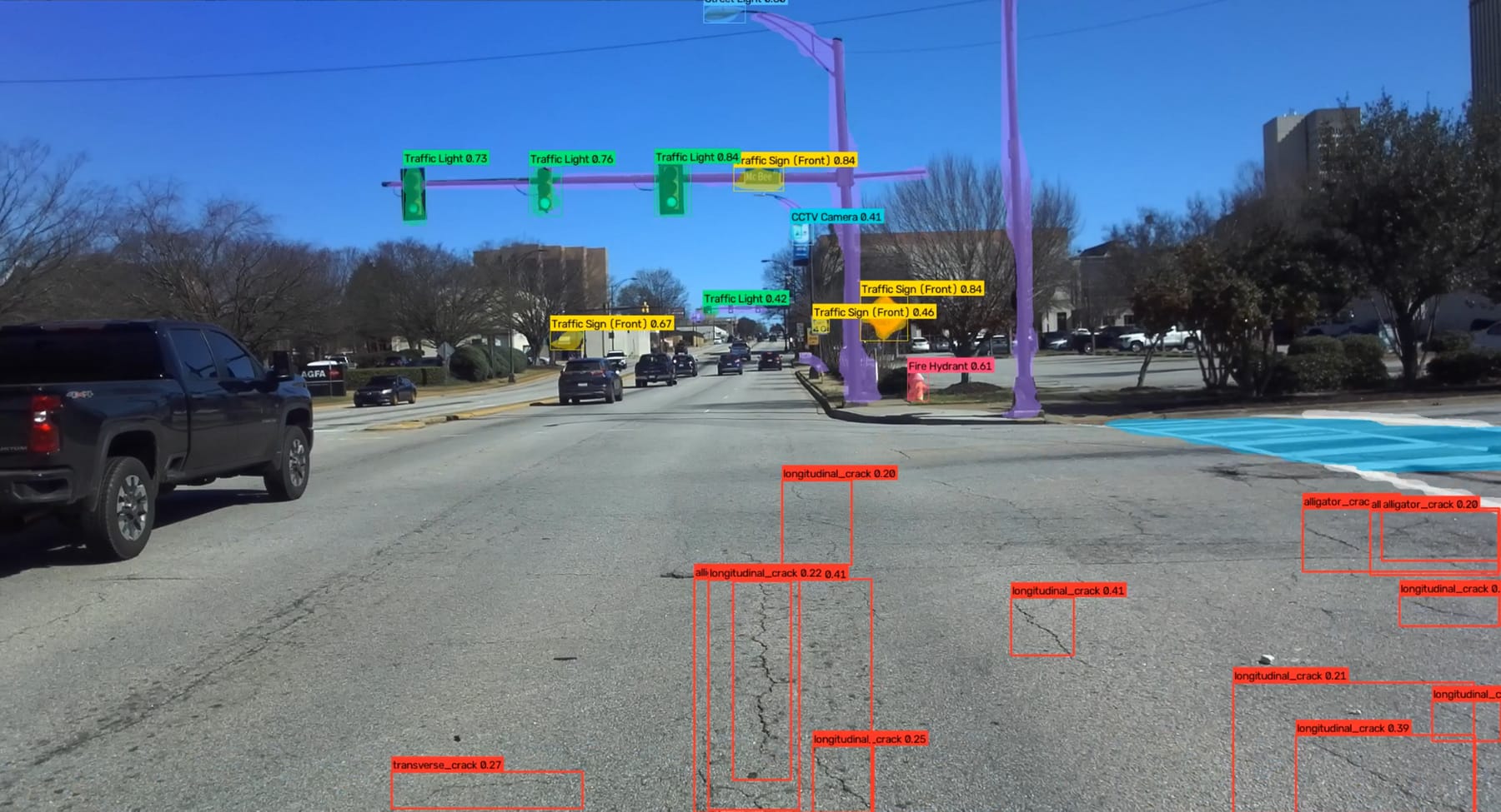
PIVAI turns an ordinary vehicle into a road inspection system. Our visual AI detects, classifies and measures everything on the road, in real time or at 2 mm survey-grade precision.
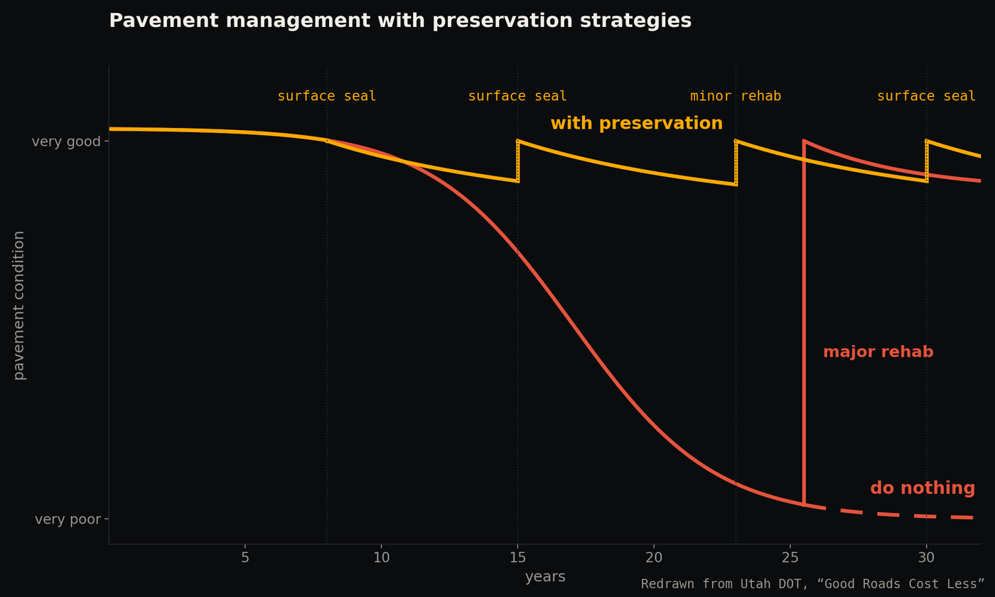
Roads deteriorate faster than they can be inspected. Most agencies still rely on windshield surveys and data that is years old. By the time a road looks bad, the cheapest fix is gone.
One AI backbone. Two ways to survey.
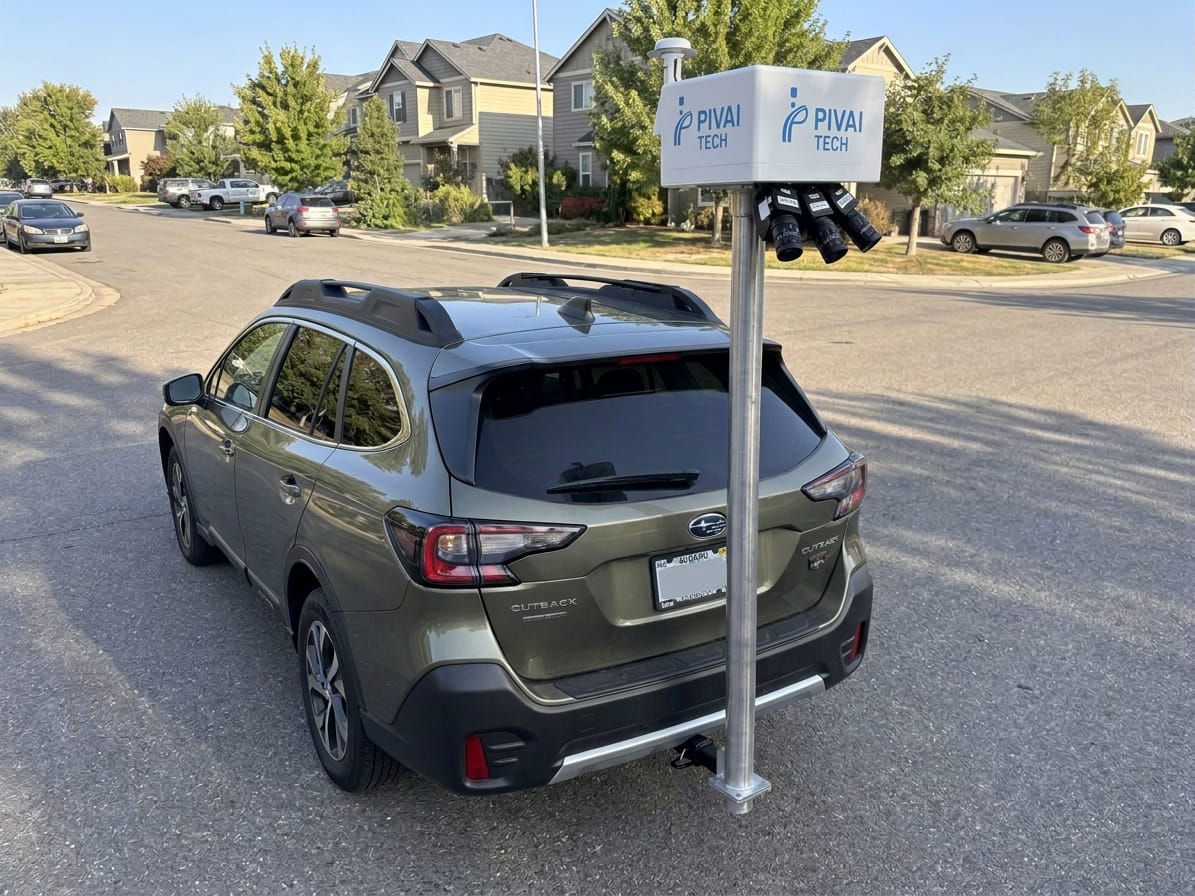
The same proprietary visual AI runs on a drive-by unit for everyday inspection and on a precision rig for survey-grade results.
Real-time detection from any vehicle.
A roof-mounted unit that finds potholes, cracks, signs, lights, poles and markings while you drive your normal routes.
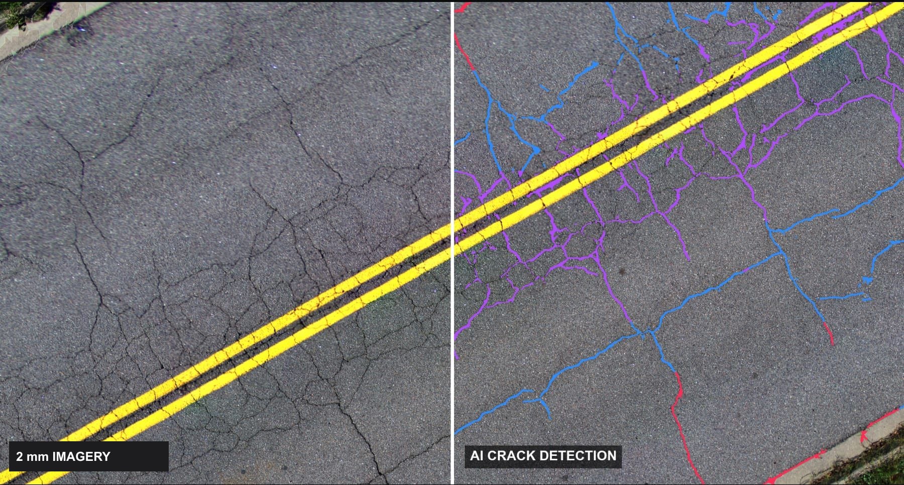
Survey-grade pavement data at traffic speed.
A hitch-mounted three-camera rig that images every square metre at 2 mm and maps every crack, with no lane closures.
From the road to the work order.
Capture in the field, review the AI's findings, explore your network on a map and export reports your engineers and GIS already understand.
 Argus Live · Route 14 · Northbound
Session
- Survey
- Network A · Day 3
- Vehicle
- Unit 02
- Operator
- J. Rivera
- Distance
- 18.6 mi
Controls
Sensors
Live detections
Route
Atlas Capture · Precision pavement surveySurvey speed
Positioning · GNSS / INS
- Solution
- RTK fixed
- Satellites
- 21
- Position σ
- 0.018 m
- Heading σ
- 0.05°
- Time sync
- PPS locked
Controls
PIVAI Review · QA queue · Network AQueue · sorted by confidence
Attributes
Severity (ASTM D6433)
- Area
- 0.42 m²
- Mean width
- 7.7 mm
- Max depth
- 14 mm
- Confidence
- 0.91
- Position
- Lane 1 · right wheel path
Decision
PIVAI Map · Network conditionLayers
Filter by rating
Network
- Segments
- 1,712
- Mean CCI
- 64 · Fair
- Poor or worse
- 23%
- Potholes
- 137
- Crack density
- 1.9 m/m²
- Alligator area
- 18%
- Potholes
- 4
- Last survey
- Oct 2026
Selected segment
Condition along segment
Recommended action
- Treatment
- Mill & overlay
- Area
- 1,180 m²
- Priority
- High
PIVAI Reports · Survey summary · Network A- Crack sealing ≥ 10 mm
- 3,920 m
- Crack filling < 10 mm
- 7,640 m
- Joint sealing
- 5,210 m
- Patching (alligator areas)
- 1,180 m²
- Rehabilitation candidates
- 9 segments
- Pothole repairs
- 137
Deliverables
Send to
Interface preview. Explore the platform
One drive. Every crack, measured.
From a recent PIVAI Atlas precision survey demo on a two-lane asphalt road in South Carolina.
Field-proven across South Carolina.
4 regions demoed · 3 SCDOT districts · 2 airports engaged · patent pending. A University of South Carolina spin-out backed by SCRA.





“Really useful to have real-time detection and back-up video to check pothole locations and signage inventory.”
SCDOT District 3 · Greenville
“It detects potholes, cracks and signage in real time, while making inspections safer during routine driving.”
SCDOT District 2 · Newberry
Where to find us.
PIVAI heads to Charleston for Beemok
Our team will be in Charleston on November 12 to meet the Lowcountry's technology, infrastructure and business community.
PIVAI at Venture Atlanta 2026
We joined the Southeast's leading technology conference in Atlanta to share how visual AI is changing road inspection.
PIVAI Atlas: a 2 mm precision pavement survey demo
One drive at 20 mph in normal traffic: 6,831 m² of asphalt imaged at 2 mm and 7,457 m of cracks mapped, measured and classified.
Build the AI that keeps roads safe.
We're a small team of researchers and engineers working on computer vision, hardware and field robotics, with real deployments on real roads.
See what PIVAI finds on your roads.
Book a demo on your own network, or ask about pricing for units and survey services. We usually reply within one business day.